DEFORESTATION IN UTTARAKHAND
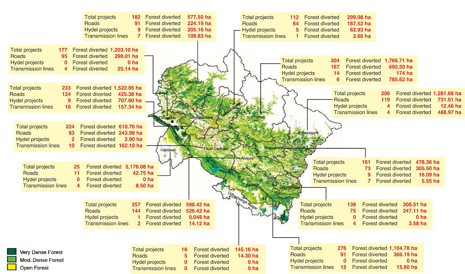
Introduction Uttarakhand was formed on November 9, 2000. It was carved out of the hilly northwestern corner of Uttar Pradesh. It stretches across an area of 53,485 sq km. Nine of its 13 districts are hilly while the remaining four southern districts are plains. Uttarakhand’s forest area has been spread over 38,000 sq km that constitutes 71% of the total geographical area of the state. Forests in Uttarakhand are endowed with unique and multiple ranges of biodiversity. From the frigid pinnacles of the Himalayan mountains to the damp Alpine clean, sub-Alpine woods, dry calm and soggy mild woodlands to dewy deciduous timberlands, the state possesses diverse biodiversity that in return nurtures a large multiplicity of floral and faunal forms. The state is home to nearly 4048 species of Angiosperms and Gymnosperms belonging to 1198 genera under 192 families. Of these almost 116 species are explicit to Uttarakhand i.e. their geological appropriation is restricted to the limits of the state. 1...